 Skoltech Space Center is happy to invite you to the seminar “The Global Land Cover Monitoring Using Earth Observations From Space”
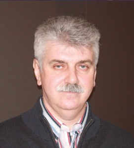
Speaker: Dr. Sc., Prof. Sergey Bartalev, Russian Academy of Sciences’ Space Research Institute
Abstract
The Earth Observations (EO) from Space provides a unique opportunity to obtain up-to-date information on the land cover for natural resources management and global change science. Optical satellite sensors currently provide the primary data source to derive information on land cover/land use and vegetation biophysical properties and their dynamics as essential input into forest and agricultural management, carbon cycle and climate change modeling, biodiversity conservation. Recent advances in satellite monitoring provide a number of data sets contributing to the research and applications goals, such as:
• Coarse to moderate spatial resolution data (100m-1km), e.g., SPOT-Vegetation, Terra/Aqua-MODIS, Sentinel-3 and Proba-V, which provide up to daily global observations;
• High spatial resolution data (10-30m), e.g., Landsat-OLI, Sentinel-2, which provide observations every 10-15 days.
A number of land cover data products of national and global coverage have been developed using mainly coarse to moderate resolution satellite data. The recent scientific achievements have resulted in new EO data processing and analysis methods and techniques developments, such as follows:
• pre-processing methods focused on clouds effects filtering, topographic normalization, EO data time-series reconstruction, etc.;
• land cover/land use recognition metrics based on inter- and intra-seasonal changes of land spectral properties derived from EO data time-series;
• locally-adaptive EO data classification methods for land cover mapping over large areas.
In particular a set of advanced Russia-wide maps with focus at generic land cover, croplands, forest species and biomass has been derived from MODIS time-series data of 250m spatial resolution using new image pre-processing and locally-adaptive classification methods. However, for quantifying land cover and, in particular, for measuring land use related changes, high spatial resolution data is needed. Ongoing land cover mapping efforts are focused on the higher spatial resolution land cover datasets. Creation of world-class global land cover products requires development of automated EO data processing chain, which could provide annual update of the maps in order to serve forest and agricultural management as well as Earth science needs.
Speaker introduction
Sergey Bartalev has PhD degree and Doctor of Sciences degree in remote sensing and experimental physics. His research interests are focused at the development of automated methods for land cover mapping and monitoring over large areas using Earth observation data. Prof. Sergey Bartalev is Head of Terrestrial Ecosystems Monitoring Laboratory at the Space Research Institute of Russian Academy of Sciences (Moscow, Russia). He is actively involved into development of the remote sensing method for the agricultural monitoring in Russia.
